Categories
Hiking

Walk the Geo Trail of High Island Reservoir

High Island Reservoir is Hong Kong’s largest water storage facility built in the 1970’s by the Hong Kong Government. It is also the last built by the Government. Since then Hong Kong has been relying on the water imported from China, resulting in being charged exorbitantly for poor quality of water while being reminded again and again by the Beijing officials that HK’s bloodline depends on China, especially when there is strong anti-China sentiment in Hong Kong.

East Dam of High Island Reservoir

Meanwhile, as a result of the reservoir project, various rock sections near the East Dam of the Reservoir were exposed, in particular the hexagonal volcanic columns. East Dam has now becomes the venue for Geo Trail, also part of Hong Kong Global Geopark of China, providing visitors opportunity to view the spectacular hexagonal volcanic columns at close range, with some signs set up along the trail for explaining geographical features.

the icon of the Geo Trail – distorted hexagonal volcanic columns

The trail is very short. You can finish it in half an hour. But there is more to see around as the scenery surrounding High Island Reservoir is pretty. It is definitely worth a visit.

The difficult way to get to East Dam

Take bus no. 94 at Sai Kung Market or no. 96R at Diamond Hill MTR station (opearates on weekends and public holidays only). Get off after Pak Tam Chung and walk along Tai Mong Tsai Road to the junction ahead. Turn into Man Yee Road of Sai Kung on the right and walk on for about 9 km to the High Island Reservoir East Dam. You will come to West Dam first before reaching East Dam.

It is about 2-hr walk from Pak Tam Chung to East Dam.

The easy way to get to East Dam

If you don’t want to walk, simply take a taxi from Sai Kung pier – choose the green taxis which are for the New Territories (red taxis are for the city). It will take about 25 minutes and Hk$105 to get to the East Dam.When you pass by Sai Kung, it may be helpful if you go to the “Sai Kung Geo-Heritage Information Centre” (off the bus terminal at the pier) to obtain some information about the Geo Trail of High Island Reservoir. The cente also operates some tours to different locations of Geopark in Sai Kung.

How to leave East Dam

You can walk back to Pak Tam Chung where you can find mini buses and buses back to Sai Kung. Also, taxis line up at East Dam to drive visitors back to Sai Kung on weekends. But make sure that you get the taxi before 3pm. After 3pm, when everybody wants to leave, it is hard for you to find one.

From East Dam, you can continue to LongKe, a serene and pristine beach with amazing view. It is only half an hour walk from East Dam.

Categories
Hiking

Leisurely walk: along Shing Mun Reservoir

This walk of 2-3 hours is probably among the most popular countryside walks in HK, for its easiness of access and walk in addition to pretty reservoir scenery.

Date: 13 Oct 2012

Route: Shing Mun Reservoir Walk – Pineapple Dam Nature Trail

The walk was really easy, all the way on concrete pavement, with most of the time commanding view of Shing Mun Reservoir, which was built in 1937. Though it was easy walk, there were enchanting views from time to time.

On the way, you may encounter cows left unattended. And beware of the many monkeys which are aggressive. I saw one jumping repeatedly at one hiker holding sandwich in his hand. Don’t show you food or you will be in trouble.

How to get to the starting point

Take MTR to Tsuen Wan (荃灣). Take Exit A1 to go to  Shiu Wo Street (兆和街) and take mini bus No. 82. The ride is about 20 minutes before reaching Shing Mun Reservoir. This is the minibus stop at the Reservoir area. To the left of the bus stop, is a staircase with signs saying that it is a “Nature Trail”. Go up the staircase.

After about a 10-minute upward hike, you arrive at a level ground and at a junction. Turn right so that you can make a bigger circle around the reservoir.

Towards the end of the walk, you will come to the main dam of the reservoir. If you follow the path leaving the reservoir, you will end up at the bus stop again, but this time approaching it from the other direction. Taking the same minibus (no. 82), you will reach Tsuen Wan again.

Categories
Hiking

Hike to Tai O

This hiking route is about 4.5 hours long. Its attractiveness lies in its destination Tai O, a popular tourist destination, and for me, a simple lunch at waterside and open view during the last leg of the hike.

Date: 16 September 2012
Hiking route: Yat Tung Estate(逸東邨)in Tung Chung– San Tau (䃟頭) – Sha Lo Wan (沙螺灣) – Sham Sek Tsuen (深石村)– Shen Wat (深屈)- Tai O (大澳)

I stopped in Shen Wat, after about 3.5 hour walk, to have my lunch. There are about four stores there offering simple food and drink. I went to the first one and ordered instant noodle with egg and sausage, the kind of food offered by a typical store on a hiking route. The table was set outdoor under the trees, with the waters just right next to you. I gorged myself on the food, feeling the wind gently blowing into my face from the sea. It was very soothing.

the store restaurant is situated next to the waters

The store I went to also offered home made star-fruit juice and salted mandarin water. They were delicious drink. The woman owner told me that the family has been living in Shen Wat for one hundred years and they grow their own vegetable and fruit. So I also ordered a plate of Chinese Potato (沙葛),grown by the family. It was so fresh and the dish so big.

After the food, it was time to leave for Tai O. Before you reach Tai O (about one hour walk from Shen Wat), you have beautiful mountain and sea view at the right.

at this point, Tai O is very near

There is generally little slope for this hiking route, only that the route may be a bit long for some people. I definitely recommend it.

How to get to starting point:
The starting point is Yat Tung Estate in Tung Chung. Take bus (No.38, 10 minutes) or taxi (HK$20, 5 minutes) from Tung Chung MTR station to Yat Tung Estate, a public housing estate. Walk through its small shopping mall and then a square. Turn right when you reach the pavement. There is a flyover there. Near the foot of the flyover, at your right, is a path. Follow it and you are now on the way to Tai O. Soon after you embark on the path, you will find wire fence and water at the right, and a waterside temple at the corner.

The route since is well signposted, bringing you all the way to Tai O. You won’t get lost.

Categories
Hiking

Hike near Yuen Long

I have blogged about Yuen Long. Besides sightseeing, you can also hike there. For Tai Lam Country Park, the second largest country park in Hong Kong, is right near.

Last Saturday, I went to Yuen Long for Yum Cha and hiking. It was near lunch time after Yum Cha. Though the temperature dropped to below 30 degrees Celsius, it was still hot. I therefore chose an easy hiking route in Tai Lam Country Park.

It is Tai Tong Nature Trail (大棠自然教育徑)。

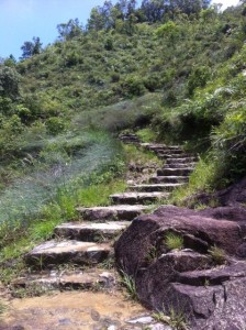
It was easy, because it was only a 2 hour walk, but not that easy, as the trail is full of steps, up and down. Some parts of the route are wet.

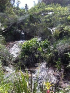
some small waterfalls on the trail

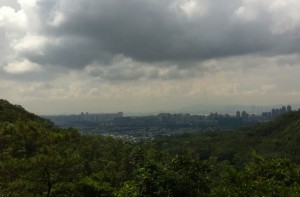
The attractiveness of the route is, it allows you to have a birds’ view of Yuen Long Plain, once the rice production area for Hong Kong, and Yuen Long centre and even Shenzhen. And a part of the route overlaps with Yuen Tsuen Anicent Trail, the path that once linked Yuen Long with Tsuen Wan, once a market town in the south of New Territories. So you can have a feel about stepping on an ancient trail.

How to get to the starting point of the Trail:
Take minibus (it  has “Yuen Long to Tai Tong” as the sign, not bus number )near CitiMall ( 1 Kau Yuk Road). Bus fare is $4.5. Get off at Tai Tong Shan Road (大棠山路)。Walking from here to Tai Lam Country Park and the starting point of Tai Tong Nature Trail is about 30 minutes. The entrance to the trail is at the far end of this barbecue site.  

Tai Tong Nature Trail itself is a 2-hour walk. The whole walk is about 3 hours though, including the time to and from the starting point.

Read here to see the map.

Categories
Hiking

Hike to view Tsing Ma Bridge

Tsing Ma Bridge, the key connection between Hong Kong and its international airport on Lantau Island, is the world’s longest span suspension bridge carrying both road and rail traffic. There is a hiking route (Tsing Yi Nature Trail) that will give you a fantastic view of the bridge. In fact, it has become the hot spot for both amateur and professional photographers to capture the sunset and night views of Hong Kong, using the bridge as the focal point.

When I was there, it was late afternoon and a bit smoggy. So I can only capture this: It is an easy short walk, for the whole length is only about 3 km.  The trail is well planned and well paved, with trail maps at all the intersections – you won’t get lost.  There are many steps to climb, though.  I finished the leisurely walk in one hour.  There are four pavilions along the way, offering some good views. Don’t miss Pavilion 3, which is the place for viewing the magnificent Tsing Ma Bridge.

How to get there:
Take No. 248M bus from Tsing Yi MTR Station to the last stop. After getting off, walk up the road (Liu To Road) for 10 minutes and you will see the entrance of “Tsing Yi Nature Trail” at your right hand side.

The exit point is Tsing Yi West Road. You can take bus to Kwai Chung, Shatin, Tsuen Wan or Tsing Yi MTR Station.