Categories
Hiking Travel Tips

A short and pleasant hiking route: Pak Sha O to Lai Chi Chong

This is a short but very pleasant hiking route – from Pak Sha O (白沙澳), Sai Kung to Lai Chi Chong(荔枝莊), to the south of Tolo Channel.

Pak Sha O village
Pak Sha O village

Pak Sha O, a one-time hakka village, is now populated with western families. You will pass a very beautiful private garden with vibrant colors, and some nicely restored old houses. Colorful butterflies are seen in scores in the area, and pink wild flowers in their prime.

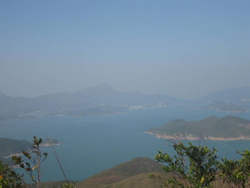
All the way from Pak Sha O to Lai Chi Chong, you are accompanied by the sound of river flowing and bird singing, not to mention the greens that meet your eyes.

It takes only 45 minutes to walk to Lai Chi Chong, whose picturesque scenery makes the place a popular site for camping.

Private garden at Pak Sha O
wild flower field at Pak Sha O

The beach has rock formations dating back to 150 million years ago when the volcano erupted. As a result, Lai Chi Chong is among Hong Kong’s most important places for geology study and rock formation observation.

cows and meadow at Lai Chi Chong
Lai Chi Chong
Lai Chi Chong
rock formation at Lai Chi Chong
the quiet pier at Lai Chi Chong
Lai Chi Chong pier

How to get there and get back:

Take minibus No.7 from Sai Kung town centre towards the direction of Hoi Ha (海下); get off at Pak Sha O. (If you don’t know where to get off, ask the driver to alert you.)

Ma Liu Shui pier
Ma Liu Shui pier

There is a daily ferry departing from Lai Chi Chong at 11:40am and 6pm for Ma Liu Shui (MTR University Station). On Saturdays, Sundays and public holidays, an additional ferry at 2:15pm is in operation. Ferry time is about 40-50 minutes.

Please check the schedule of the ferry here. Each adult ticket is HK$28 during the weekends.

Note that after you arrive at Ma Liu Shui pier, you have to follow the road signs to walk at least 10 minutes before you can arrive at MTR University station.

Categories
Hiking Travel Tips

Easy and beautiful walking trail in Sai Kung

The route is in Saigon, from Hoi Ha Village to Wan Tzai. The first part will be treading a path around the Hoi Ha Wan Marine Park, which is protected and does not allow any fishing or interference of human activity. The water of the sea is therefore as calm and clear as a mirror. The Marine Park is simply serene.

The second part involves Wan Tsai, which is a small peninsula. Originally a burrow area, it was converted to become part of the Sai Kung West Country Park in 1996.

Wan Tsai s renowned for its picturesque natural setting and sweeping vistas of some coastal gems like Tap Mun. With nature trails and large camping facilities in the area, Wan Tsai is very popular with youth organizations arranging camping activities for the kids and the young.

The most pleasant walk, speaking from my personal experience, also lies in this part, Wan Tsai – with wide paths lined with tall green tress, dotted with yellow flowers – just like a shady boulevard.

How to get there:

Take minibus No 7 from Sai Kung, all the way to the last stop. The bus ride is about 30 minutes. Every 20 minutes there is a bus.

Where you get off the bus, is the entrance to Hoi Ha village. You will see a map on display showing the hiking routes in the area.

At the first crossroad after entering the village, turn right to a string of restaurants. Carry on and you will be on the way to see Hoi Ha Wan Marine Park at your left.

After half an hour walk, you will come to the intersection between Hoi Ha Wan and Wan Tsai. Just carry on, and soon a camping site appears at your left.

If you just go straight, you will find yourself see more camping sites unfolding, and then after some walk, you find youself having made a small circle and back to where the first camping site is. Then follow the original route back to Hoi Ha village, and take the bus back to Sai Kung.

If you don’t want to go the original path back, you can take ferry from a pier in Wan Tsai (which is inside one of the camping sites) to the Yellow Stone Pier, from where you can take bus to Diamond Hill MTR station.

Duration of the walk (from Hoi Ha village to Wan Tsai, and then back to Hoi Ha Village): 2-2.5 hours

Categories
Hiking Travel Tips

The most beautiful country trail in HK

I walked this country trail just a few days ago, only to be stunned by the beautiful scenery the trail has to offer.

A well kept secret about Hong Kong is that 70% of its land is country parks. The city is abundant in country trails leading to enchanting natural landscape. And though I am not a keen walker, I have walked quite a few trails over the years. But the most recent walk, along the Long Ha Wan (literally meant “lobster bay”) country trail, has impressed me most with its majestic beauty.

How to get there:

Take minibus 103M at the bus terminal of Tseung Kwun O MTR station, or minibus No. 16 at the bus terminal of Po Lin MTR station. Ask the driver to drop you off at the roundabout leading up to Clear Water Bay Country Park entrance.

It will be about 10 minute walk before you arrive at the entrance. At the left is a parking lot. Go through it and you will come to a steep road leading up to the mountain.  A map outlining the Long Ha Wan route is on display at the bottom of the road.

The climb will take 20-25 minutes. Once you reach the top, you will find yourself surrounded by seas and islands.

Going downhill is easy and pleasant. But once you reach the exit of the trail, you will need to walk at least half an hour to be back at the roundabout to catch a bus back to the city.

Duration: about 2.5 hours

Categories
Hiking Travel Tips

Hiking in Hong Kong – Dragon’s Back

The Dragon’s Back hiking trail is on the eastern end of Hong Kong island. I recommend this trail because it is pretty easy to walk and the scenery is marvelous. Even the kids can join.

Here are some photos of the scenery along the trail. It was a bit smoggy the day I took the photos. It would look more beautiful if the sky was clearer.

Duration: about 2 hours.

How to get there:

Take MTR to the Shao Kei Wan Station. Head to the bus terminal to take bus No. 9. Get off at the Cape Collision stop, where Tai Tam Gap Correctional Facility is situated. Next to the correctional facility, is a stone staircase leading up to the trail. Follow the trail and the sign “Dragon’s Back” (龍脊), and you will be well on the way.

After about 1 hour’s walk, you will come to the top of the mountain, commanding a beautiful view of the sea and mountain. Going downhill, follow the direction going to the “Shek O Road”. Once you arrive at the Shek O Road, at an area called To Dei Wan (土地灣),  take bus No. 9 in the opposite direction and you will be back to the Shau Kei Wan MTR station.